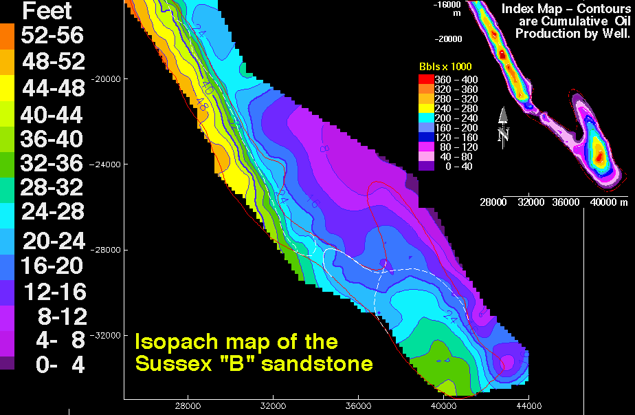
 This image is a Isopach map, of the Sussex "B" Sandstone. an Isopach map is a map illustrating variation of rock or sediment thickness. This map has an Isopach line (contour intervals = 4 ft) that depict the thickness of a rock layer known to produce oil at a countour interval of 40,000 barrarells.
http://http://www.google.com/imgres?imgurl=http://pubs.usgs.gov/dds/dds-033/USGS_3D/ssx_gif/ssxiso.gif&imgrefurl=http://pubs.usgs.gov/dds/dds-033/USGS_3D/ssx_txt/petrol.htm&usg=__uNCiSHjhQscoMEv63kGB-mTHBH4=&h=603&w=924&sz=39&hl=en&start=3&sig2=F70DgPXmxHYbW2ekMGMszw&tbnid=mwavILFW06FX0M:&tbnh=96&tbnw=147&ei=BVZTTPmZJIP-8Aamy4ygBA&prev=/images%3Fq%3Disopach%2Bmap%26hl%3Den%26sa%3DG%26biw%3D1276%26bih%3D579%26gbv%3D2%26tbs%3Disch:10%2C261&itbs=1&biw=1276&bih=579
No comments:
Post a Comment